'Boulders'
-
 by
p.titchin
by
p.titchin
Here you are Kith- early musings on 'boulders.
At present I am looking at three types:-
(1) Snow/ice balls.
(2) Cemented ice/soil lumps.
(3) Rocks:-(a).Impact ejecta.
(b).Fractured pieces following erosion of ground, gulleys,cliffs etc.
Terrain is all important, eg, the freeze thaw cycles on 'patterned ground' allow for the movement of type (3) to the surface,and also could be directly responsible for type(2) and their subsequent 'sorting'.
Hope some of you can add to/ edit my thoughts as I continue to "boulderly go" ~Pete 😃Posted
-
 by
Kitharode
moderator
by
Kitharode
moderator
Nice one Pete. I'll feed in whatever I can. Not knowing what you already have in your image collections, you'll have to forgive us if we feed you nothing but duplicates. 😉 I've hit the 'Follow' button and look forward to developments.
Couple of items that might be nonsense, but I'm good at nonsense so I'll mention them anyway: Boulders seem like a prime target for movement. You're already looking into 'polygonal shift' and those cliff-boulders I posted certainly look like movers to me. If movement is part of your plan, then do let me know if some types/areas need looking out for.
Then there's the 'pebble-dash layer that's being exposed' thingy. This is a (very) vague idea that I can't get away from, but perhaps it's worth some consideration before being thrown in the bin. Basically, in a lot of images I've seen I get a strong impression of 'boulders poking through the surface'. The idea of a lumpy, 'pebble-dashed' layer, covered by a smoother layer of material always springs to mind. I've always had a feeling that the lumps/boulders might be the tips of the raised pebble-dash layer underneath poking up into the sunlight. The smooth layer might be eroding away to reveal these tips, or it might be settling and eventually bury the tips. If I come across an example of this I'll post it here.
Good hunting. 😃
Posted
-
by
angi60
in response to p.titchin's comment.
Yes, I'll keep my eyes peeled too Pete. Good luck.
Posted
-
by
Kitharode
moderator
Pete: Mainly for you, but something for everybody methinks (Angi?). My interest in this image is the impression of 'flow', or more correctly 'creep'. I'm into slippy-slumpy-slidy-creepy material especially on crater floors and other confined spaces, like Inca City zones. If anybody sees any of this stuff I'd love to see it on the 'Spider on Cube...' thread. (I'm ok for Inca City - got all them!) Cheers. 😃
Top right corner for you Pete. I think there's a readable story for this scenario, but I've no idea about timescales. If you see what I see, I think this scenario will fit several (many?) other examples. I'd be interested to hear your thoughts.
http://viewer.mars.asu.edu/planetview/inst/hirise/PSP_005650_1005_RED#start Lat -79, Long 297 E. (180km-ish north of Inca City).
REMINDER: The MRO Image map 'data box' shows Lat/Long as -90 / 0 deg for all south polar images. I checked this with the tech team and it's correct. It's what they do, they told me what, didn't understand a word. Just so's ya know. 😃
This'll get the juices flowing: http://viewer.mars.asu.edu/planetview/inst/hirise/ESP_023015_1055_RED#start
Posted
-
by
p.titchin
in response to Kitharode's comment.
Hi Kith. Sadly can' get your images to download. Just says 'checkaddress'.
Regarding your 1st post,
1- "Movement"
'a' movement by the sorting action,(lateral) and inhumation/exhumation,(vertical) occurring in freeze/thaw cycles. The 'happy hunting grounds for these are the 'patterned ground' regions.
'b' gravitationally induced movement of eroded fragments from cliff edges ridge tops and crater rims. These may be boulders that simply roll down hill. (quick) or boulders that are on ground that 'slumps' (slow). this latter like your 'creep'. This image APF0000j7i is possibly a site where both have occurred/are occurring.
2.-Exposure/Covering . What indeed is happening on 'pebbly' ground. APF0000zkk is an image where I think all stages are shown, from completely covered to totally exposed, (with a smidge of an associated vent!).
The Mars 'question mill' continues to roll! The main barrier to trying to interpret the images is time scale. It is so fundamental to putting together the sequence of events.
Another spanner to throw in the works is - Unless 'boulders' are just ice balls, why are they mostly white? If they have darker insides, wouldn't they warm and melt/sublime their coating of ice? If on an ice surface, wouldn't they 'sink' through the ice? how can the opposite occur?
Again, it is essential to know the time scale of events.
That is enough to be pondering, I think. As always, if any of you out there have any thoughts or images, please join in on this thread. All contr4ibutions gratefully received!Kith, if I spot any non-Inca city ? 'creeps' I'll post them. ~ P4 Pete. 😉
Posted
-
by
Kitharode
moderator
in response to p.titchin's comment.
Pete. Does that mean you can't see the images, or you can see them but can't download them to save? I've just used the links and they're good for me. If needed (because they're really interesting) I could probably find the HiRise link. We have similar ideas for some of these boulders, which is good I think. Some nice new ideas too. Well done.
Yes, creepy stuff away from Inca City. Probably better to say anything you find between longitudes 90 - 270 deg. 😃
EDIT: Here's the HiRise page for first link above (top right corner Pete) http://www.uahirise.org/PSP_005650_1005
and the awesome boulders creepy crater (2nd link) here http://www.uahirise.org/ESP_023015_1055
Posted
-
 by
wassock
moderator
by
wassock
moderator
"nd image is interesting, I'm seeing the wiggly lines right of the central ridge as dust devil tracks. If that's what they are it shows that the surface is different on either side of the ridge - Those tracks which reach the ridge vanish, the left hand side is thus hard and rocky the right soft and sandy
Posted
-
by
Kitharode
moderator
in response to wassock's comment.
Sorry, I can't see the wiggly lines. Where's the central ridge? Is it the lower of the two linear features on the right of the crater floor?
Posted
-
by
wassock
moderator
Sorry 1st image - PSP_005650_1005 = the gretscale jpg
Posted
-
by
Kitharode
moderator
That works !! 😉 Great idea too.
So what do you know about the devils? I know what one is, but that's about it. Do they leave those sorts of tracks? Are they like channels? Why so many in that area? Would these be old tracks or more recent? etc., etc.
Posted
-
by
p.titchin
in response to Kitharode's comment.
Thanks again, I only got 'server' not recognised, but the HiRISE links work fine! My juices are indeed now flowing!! ~Pete
Posted
-
by
wassock
moderator
Think the theory is that they disturb the surface layer of dust to leave a track, which persists for a while then fades. Lots of them on HiRise try doing a search, seem to be common in dune areas.
Try this one for starters http://www.uahirise.org/ESP_013751_1115
Somewhere If posted about these tracks on some dunes, the tracks come and go but the dunes move not. Can't find it though - not titled dunes
Posted
-
by
Kitharode
moderator
Fabulous. I've seen quite a bit of this (I called it 'wet hair') but never made any sense of it. I understand the idea of the 'scolloped' thingy and rubbing out the front of the vortex, but I admit I can't make it out yet so couldn't tell direction. Liked the bit about 'low-speed ambient wind' and following wind direction. That sounds like it could be useful, but I guess only for summertime(?)
Might make a collection. 😃
Posted
-
by
angi60
in response to Kitharode's comment.
Brilliant images Kitharode. I had the same problem as Pete so I'm glad you posted them again. Good clear trails of 'sliding' boulders on the second image. I haven't seen dirt devil trails before! Fascinating.
Wassock: Thank you for enlightening us about dirt devil trails!
Posted
-
by
p.titchin
in response to Kitharode's comment.
Love the first image, and the dust devil trails (thanks Wassock for the info.). I love the way the softer ground has flowed over the left side, particularly the way it has started to flow into the small crater 2/3 the way down the boundary line. As always, I wonder what the time scale is. The second image is amazing. What an incredible crater. The colour (Apart from the shadow!)and texture differences in the flow deposit are fascinating. I'd love to get greater magnification of the edge of the flow on the right side, and once more, I wonder what the time scale is.~Pete
Posted
-
by
wassock
moderator
Hadn't picked that you were looking at boulder tracks - there are a lot of those on the moon where I think the idea is that the boulders are impact ejecta and the tracks of where they rolled are still there cos there is no wind
Posted
-
by
p.titchin
in response to wassock's comment.
thanks for the tip Wassock.
On another boulder topic, bugs/ non- bugs, and spiders with boulders, APF00017ym shows what is maybe an eroded 'bug' with ? boulders in the middle, and APF0001rmy has what look like small boulders in some of the spider channels. I wonder how these affect gas flow and further development.Posted
-
by
p.titchin
in response to p.titchin's comment.
Following up on Wassock's tip to look at boulder movement on the moon, there are loads of moved boulders, which can be tracked because there is no wind, and the tracks are not obliterated. Although at first glance these tracks appear to occur often, in fact subsequent meteorite strikes on them show many to be ancient, and not as frequent as appears. On Mars, the tracks are likely to be covered due to wind and dust, unless recent. The movement can start during the strike forming an impact crater, or by falling down slope. On Mars the gravity is higher than the moon, and our boulder will take more to get it moving, and it will not roll so far. ie, tracks on Mars are likely to be less common, less obvious, and short lived.So, if anyone is lucky enough to spot what may be a track on the side of a ridge or crater or in crater ejecta,, please please let me know on this thread.
Posted
-
by
p.titchin
in response to p.titchin's comment.
Earlier, I commented that I was puzzled that the majority of our polar boulders are very high albedo, appearing as bright white. To my surprise, whist looking at lunar boulders, I found that whilst images taken on the surface show dark coloured boulders, from orbit, the boulders have a high albedo and appear bright white! EUREKA! Boulders on Mars are not all ice/ice covered! Any Physics gurus out there on the 390-740 nm. EM radiation that can explain this effect in simple terms?
~PetePosted
-
by
Kitharode
moderator
in response to p.titchin's comment.
All very exciting. I'll certainly keep my eye open for 'fresh' tracks.
I've no idea why dark boulders on the surface of the Moon appear bright from space, but I'll accept that they do. However, is this fact enough on it's own to 'prove' that martian boulders are doing the same? (Sorry to dampen your Eureka moment) 😃
Posted
-
by
p.titchin
in response to Kitharode's comment.
absolutely not Kith, but my moment was that I could now accept that at least some of my boulders were rocks, not snowballs!
Posted
-
by
p.titchin
in response to p.titchin's comment.
Have a look at the greyscale map projected image on this clip. APF0000xdq . There is an unusual irregular depression which has much of interest. Firstly there are lots of boulders around and in the depression, much there for me to look at!, then there are several landslips along the upper edge (lower edge in non map), there appear to be layers inside the upper edge on the floor,(maybe of note for Kith), there are polygons in the crater floor, and what look like small impact craters outside and inside the depression. Lots going on, any comments looked foreward to with interest!
Thanks to Angi 😃 for spotting this one and flagging up the boulders.Posted
-
by
wassock
moderator
Same area, 2012 - first is 2007, looks pretty much unchanged. Though the round 'blotchy' thing south of the depression may be subtly different between the 2 images?
http://hirise.lpl.arizona.edu/ESP_028644_1105
This is the only other image of the same area I could find, but the title suggests there should be more (Observe seasonal defrosting prcess)
Posted
-
by
p.titchin
in response to wassock's comment.
Wassock, thanks, I just wish I could view these stereoscopically. On first look, there are isolated boulders that have moved, and most mysterious, the' round blotchy' feature on close examination has a dark circular line outside it, that has apparently significantly increased in diameter in the passing years,. (a couple of features on or outside the ring in the first image are well within the ring on the second) Mars continues to mystify. I ,so far, have no ideas on this .I need to be able to isolate and compare these images. It is impossible trying to switch through the site to compare, but many, many thanks for finding the later image.~pete
Posted
-
by
angi60
Hi Pete. I don't deserve your thanks, being as I didn't actually point this image out to you!! Firstly. unusually for me, I didn't actually look at the HiRise images, so had no idea they were so fascinating! Secondly, for future reference, I don't actually know how to insert a link into a Talk thread. should I want to point an image out to you.
I couldn't believe how clear the image was! Some of the images of this sort of terrain look like an awful 1970's carpet because they appear to show numerous green or grey blotches amongst the boulders, along with track-like markings. (I seem to remember discussing them quite some time ago because the colour intrigued me.) The track-like markings throughout the whole of these images seem to be unique to this sort of terrain. The various depressions in the HiRise image are fascinating too! Enjoy!! 😃
Posted
-
by
p.titchin
in response to angi60's comment.
Lots of thanks due Angi. Your 'recents' posts are a rich provider for my collection as you always mention any boulders you spot. 😃 It's also nice to find out there is someone else that's not a computer wizz among us P4 explorers. I only know about the image links because the site automatically does it when you type in the image number, like it does with smiley faces! ~Pete
Posted
-
by
PaulMetcalfe
Here are a few images that have boulders (some on spider tops). You probably have these.
APF00002kf
APF00004vs
APF0001374
APF0001a9m
APF0000uxk
APF0000avmPaul
Posted
-
by
p.titchin
in response to PaulMetcalfe's comment.
Thanks Paul, Ive popped it in my collection. You also posted an interesting one in 'recents'. It shows some boulders, or angular hills/ limpet cones> They get called many things and are a bit strange. Apart from my interest in them, Angi60 has an interest, so I have posted it onto her thread (conical mounds, limpets etc) on this board. Many thanks ~Pete
Posted
-
by
PaulMetcalfe
Just for information - would you class the features (mainly at bottom of image) on APF0001suj as boulders or rough terrain?
Posted
-
by
p.titchin
in response to PaulMetcalfe's comment.
This image has lots of boulders throughout. There are also lots of small icy pockets within the spider channels. Quite a few of these are near the lower edge. Not sure which ones you are looking at , but there are probably some of each. The boulders are smaller and more regular in appearance. There are also small icy hummocks, ?(rough terrain) which may be just that, but some think that they are pieces of permafrost ground in the process of separating off and becoming a type of " boulder It is not very easy as we would need to see the same site over many years to know.Hope this helps ~Pete
Posted
-
by
angi60
in response to p.titchin's comment.
Hi Pete. Haha - it's good to know I'm alone in being a Luddite with computers! I'm definitely not a computer wizz kid (and most definitely NOT a kid 😦 )Ah, I didn't realise the link is inserted automatically when you type in the image number! Thanks for enlightening me 😃 My computer skills have certainly been improving since I came to P4, I'm glad to say!
It's good of you to thank me. I try my best with classifying, although sometimes I worry that I 'flag up' too many images!! I promise I'll keep pointing out the boulders though 😉
Right, talking of which, I'd better actually do some classifying! BOULDERS here I come.....
AngiPosted
-
by
PaulMetcalfe
Hi Pete
I have posted a boulder related question for you on my thread 'Just a Spider theory' so as not to clog up your thread with stuff irrelevant to your investigations. I hope you look at it.
Paul
Posted
-
by
p.titchin
in response to wassock's comment.
Wassock, found another image of this odd feature. Greyscale for APF0000xaq . 24/12/2006. There certainly seem to be some changes since then. I'm still trying to work out a way of comparing the magnified images properly ~Pete
Posted
-
by
wassock
moderator
2006 this one, really early in the year, SL 155, so should be all ice on the surface. the round blotch now looks like a depression on the HiRise grey scale.
best bet for looking in detail is to use the HiRise viewer (HiView, download from the HiRise page at the bottom) to zoom and crop on the area of interestPosted
-
by
angi60
Hi Pete. Not sure if you have this image already, but it has some striking boulders! APF0000zm0
Posted
-
by
p.titchin
Thanks Angi, I'd just spotted it in your image posts. It's interesting, because most of the boulders seem to be partially covered. (or -partially uncovered! ) The Inca City ridges are a happy boulder hunting ground, but I still have not got any ideas as to the way they are formed, and why they occur so much on and near the ridge crests. At present I am just trying to collect the images and see what changes with time occur. Thanks again ~Pete
Posted
-
by
angi60
in response to p.titchin's comment.
You're welcome Pete. It was high time I returned the favour! Yes the HiRise RGB of the image is amazing. Just keep soldiering on with the collecting and I'm sure you'll have a eureka moment 😉 I haven't got any conclusions with my angular hills yet either!!
Posted
-
by
angi60
Hi Pete. Scummer80 has asked me to pass on image APF0000x7s to you, in case it's of interest. Sorry to hear you're still having problems accessing the site. My problems seem to have settled down, so I hope your's do soon. Angi
Posted
-
by
Scummer80
Image APF0001h8g Image APF0001gwc Image APF0000zd0
Perhaps these are what you're looking for? I'm fascinated by the third one, the boulders (if that's what they are) are so round and quite flat I think, and there seems to be some sort of track mark behind one in the top right!
Posted
-
by
Scummer80
Image APF00011gg This one's interesting too, not sure what to make of it, boulders in dust blotches?
Posted
-
by
p.titchin
in response to Scummer80's comment.
Thanks Scummer80, this is a good one with partially exposed boulders. Much venting activity is found associated with boulders, and many vents are associated with spiders, often with boulders in the spider channels, but not all vents have boulders, and not all boulders have vents. All adds to the fascination of what we are seeing. 😃 ~Pete
Posted
-
by
Scummer80
Image APF0000zn4 very round boulders!
Posted
-
by
p.titchin
in response to Scummer80's comment.
Yes, another good image from the Inca City ridges.
Posted
-
by
Scummer80
Image APF0001zpv Image APF0001ist Image APF00011jo 😃
Posted
-
by
wassock
moderator
First one reminds me of a big slab of melting candle wax
Posted
-
by
Kitharode
moderator
Second one reminds me of mouldy bread...
Posted
-
by
Scummer80
Image APF0001f9d and maybe some in top left of Image APF0001zy5
Posted
-
by
Scummer80
Image APF0001i2n And some very shapely boulders here! Image APF0000zfu
Posted
-
by
Scummer80
Image APF000116t Image APF000125p Image APF0001fdl Image APF0000zhx Image APF00023r1
Posted
-
by
p.titchin
I have been looking through my images for obvious 'moved' boulders, and think the following remains the clearest and most fascinating image. Take the link, and then click on the RGB colour (non map projected) option. Half way down the image is a crater. The upper rim is surounded by boulders (I presume, ejecta) but roughly on the top centre of the rim is a clear landslip, and the boulders have fallen into the crater. Some have rolled on for a considerable distance. Unlike similar lunar images however, the tracks have long gone. link- http://www.uahirise.org/ESP_023015_1055 Enjoy!, and if anyone has any similar, I'd be pleased to see them. Thanks~Pete
Posted
-
by
Kitharode
moderator
in response to p.titchin's comment.
Funny innit? Spend months seeing nothing but spiders and boulders, then when someone asks for them you can't see hide nor hair of them !!
Posted
-
by
JellyMonster
Hey Pete, what do you think is happening here?
http://talk.planetfour.org/#/boards/BPF0000002/discussions/DPF0000b1p
Posted
-
by
Kitharode
moderator
in response to JellyMonster's comment.
Any idea of the lat/long for these?
Posted
-
by
p.titchin
in response to JellyMonster's comment.
Hi JM,what a pair of crackers!, Hi Kith, like you, I would like the lat/long, but for the moment, I am thinking it is probably on the permanent ice sheet. The following is all conjecture, but I'll punt it out for discussion.
(i.). I have come to think of this type of 'boulder' as being ice or ice covered lumps of surface matter. They are often associated with vented material, as in this case, where they seem to be surrounded by a small ring of dark material.
(ii). In the second image the ice sheet seems to have thickened, enveloping more of the 'boulders' and covering the dark surrounding matter. The ice 'shells' on the large lump, and the right hand lump seem to have eroded or sublimed to reveal an inner dark 'kernel'. ( Might be significant that these 2 seem to be the higher lumps) Perhaps I can start a new cat. of boulders called "ice pearls" 😃 I'm just hoping these are not on the permanent ice.
I'll continue cogitating ~Pete.Posted
-
by
JellyMonster
in response to Kitharode's comment.
Any idea of the lat/long for these?
In a word, No. Should I know the answer to this?
Posted
-
by
Kitharode
moderator
in response to JellyMonster's comment.
Hi JM. Just thought you might have access to the original 'cutout' image with the HiRise link under it which would have given us the answer. Not important really, but I do like to know where things are if poss.
Pete: I get the feeling these are more akin to bumps/mounds in the surface, rather then yer classic boulders on the surface, but I'm unsure either way. Thanks for the update - fascinating stuff.
Posted
-
by
JellyMonster
Oh, I see what you mean. I have hundreds of images in my collection but none of them have been categorised. However I did find this which looks to be in the same sort of area - APF0000iwe. Just found this - APF0000iw5. The HiRise image is definitely worth a look.
Posted
-
by
p.titchin
in response to Kitharode's comment.
Thanks Kith, I largely agree with you.I have categorized these types of lumps separately, but still as 'boulders', because most markers have hash tagged them as such. I have some of them that look like mounds, and others that appear to be more on the surface than in it. I feel that they are composed largely of ice, but containing either rock or frozen aggregate that the ice has formed on. The old 'gut feeling' tends to frozen aggregate at present, as I think that venting plays a part in their formation, (rather than the other way round). All conjecture , of course!
------------------------------ Jelly Monster, thanks for the image. Good old Inca City! The following are other some of the many similar images from the same area. APF0000j7i , APF000036a , APF0000ztn , APF0000ir0 , APF0000zts. The associated HiRISE images are fascinating. ~ PetePosted
-
by
wassock
moderator
Meg has put a blog post up about boulders:
http://blog.planetfour.org/2014/03/18/boulders-in-inca-city/
Posted
-
by
wassock
moderator
Now here's a thought:
Much of the South Pole is covered with layered deposits made up of a mix of CO2 ice (and some water ice) mixed up with dust from the atmosphere. These form a layer up to 3 km and more thick. Back home the Antarctic is covered with a kilometers thick layer of ice. Any lumps of rock found on top of this are meterorites, because thats the only way they could have got there (African swallows excluded). Does this mean that any true boulders, rather than aggregates left behind in a thaw, we see on the spld are extra-Mars in origin? If the nature of objects hitting Mars is similar to Earth then a far number of these will be metallic and have very different thermal and resistance properties to rock. Which may or may not affect egg prices.
So do we have any boulders on top of the permanent ice cap?
Posted
-
by
wassock
moderator
This is from Ithaca which I think is plum on top of the layers HiRise http://www.uahirise.org/PSP_005589_0950 scroll all the way down the rgb .jpg and it should be obvious, plenty of other candidate lumps on there, but this one has the best shadow
Posted
-
by
p.titchin
Just had an enforced break from P4 and 'boulderly going' for 3 weeks, but hey, silver linings----convalescence gives me hours extra to catch up. I left the (relatively speaking) sparse boulder images of Manhattan, and return to find great boulders all over the boards and'recents'. Its taken me several hours to hunt them down and 'collect' them. Good to be back! 😉 ~Pete
Posted
-
by
Kitharode
moderator
Ahhrrr ... Cap'n Boulder. Good to see you again. (Nothing serious I hope?).
Question: When we look at objects like the one above, how can we can be sure that we're looking at a boulder and not just a bump in the surface?
Just had a look at the HiRise image from wassock's post above. To me the surface looks bumpy, not bouldery. I get the impression that either a rippled (bumpy) layer is being exposed by erosion of the layer above, or the rippled layer is being filled in by material leaving the peaks of the ripples exposed as bumps ... ?
Posted
-
by
p.titchin
in response to Kitharode's comment.
Ive struggled with this myself,and particularly the last four or five months have looked at many images on the 'recents' that have been hash tagged as boulders or boulder fields that I have not collected into the boulder category as I felt they were possibly surface 'bumpiness'. I had thought possibly that erosion was exposing the lower features, but your alternative of covering is I guess just as likely. I'll continue to ponder!. ~ Pete
Posted
-
by
wassock
moderator
I'm working on the basis that something which throws a discrete shadow in an otherwise shadowless landscape gets to be a boulder (or at the vey least a decent lump) most of the bouldery stuff in the wider area on the above doesn't throw shadows, but some of it does. Picked this one because it has a triangukar shadow
Posted
-
 by
Portyankina
scientist
by
Portyankina
scientist
Hi!
Interesting to see a boulder in our monitored areas and outside Inca City. But we need more then one 😃
No boulders in the areas of spiders is some kind of hint/proof that the top surface thre is sedimentary layers, most probably from Polar Layered Deposits. I think, one boulder does not make lots of difference for this. Inca City stands out a lot boulder-wise, most probably because it has some additional impact-related history, but we do not know yet how exactly it originated, so nothing is certain.
AnyaPosted
-
by
p.titchin
in response to Portyankina's comment.
Hi Anya, not sure what you mean by no boulders with spiders.This image APF000136g is one of many I have of spider channels with multiple boulders. If it is a particular type of spider you have in mind, I can look further if you like. ~ Pete
Posted
-
 by
mschwamb
scientist, translator
in response to p.titchin's comment.
by
mschwamb
scientist, translator
in response to p.titchin's comment.
Interesting, because when I look at APF000136g , I don't see boulders just frost. Where do you see boulders?
Cheers,
~Meg
Posted
-
by
p.titchin
High Meg , e.g.= just below centre there is a long line of frosty channel running left to right. There appear to be several boulders just below this. There also appears to be a small group near the right edge between 1 o'clock and 2 o'clock. There are also 'snowball' type boulders scattereed about, and more isolated ones harder to point out. Cheers ~ Pete
Posted
-
by
Kitharode
moderator
Yes, under the central frosty bit there does seem to be a bit of 'bouldery' stuff about. Looks a bit more 'Angular Hilly' towards bottom right to me.
Posted
-
by
wassock
moderator
Meg, if not boulders then they are at least "sticky up bits" - the bright/shadow is the other way round to the spider channels. And the are a couple in there with limpet tendancies too.
Posted
-
by
mschwamb
scientist, translator
in response to Kitharode's comment.
Still that looks all that topography associated to the channel carvings to me and frost. At least to my eye, I don't spot boulders like wasock image on p7 or like we see in Inca City in this image.
Cheers,
~Meg
Posted
-
by
p.titchin
in response to mschwamb's comment.
A couple of the 'boulders' in the image look very like some of the Inca City ones to me, but have a look at these two very different images which appear to show a type of boulder or surface lump + spiders. 1- APF0001s88 and 2- APF0001gzl .~ Pete
Posted
-
by
JellyMonster
Pete... I'm pretty sure the first image shows depressions and the second, boulders.
Posted
-
by
wassock
moderator
Wouldn't have gone for boulders in the first but t'other one is showing some very pointy shadows
Posted
-
by
p.titchin
Jelly and Wassock, you are right! The first shows depressions. Shows the dangers of quickly picking an image from hundreds without checking it in larger format first. I'm pretty sure the second image has boulders and spiders though. ~pete. PS here is a recent image that appears to show a 'nest' of boulders in the body section of a spider. APF00010x3
Posted
-
by
Kitharode
moderator
Nest of boulders - nice description. On the lower edge of the nest area (and around it) are objects that are more similar to Angi's Hills than boulders (to my eye). As with the Angular Hills, I often get the impression that they are 'islands' being created by the channels between and around them. As the spidering becomes wider the islands become more isolated.
Perhaps these 'bouldes' are the remnants of such islands.
Or not ... 😉
Posted
-
by
angi60
in response to p.titchin's comment.
Hi Pete, I've missed this discussion until now. Image APF0001gzl is like the images I've been collecting, with what I've been calling conical hills (these could be underdeveloped version!). They are mainly centred on radial spiders that have narrow, crack-like channels. My images show them in the Manhatten area. I haven't seen them anywhere else (yet). Hope your better now Pete.
Kitharode: Yes I can see the similarity to the Angular Hills, and I've been thinking along the same lines. The flattened are in image APF00010x3 is very reminiscent of the spiders that appear in the 'limpet' mound areas, again in Manhatten.
Posted
-
by
p.titchin
in response to angi60's comment.
Hi Angi, good to hear from you. In all these musings, it would be so nice to have some idea of the time scale of the development of these features. Apart from the obvious ejecta around impact sites, the features being called 'boulders' are often enigmatic. Are they exposed hillocks, 'snow balls, or as Kith suggests, bits left in between erosion channels.
- Kith, thanks for your comment. I've tended to think that the spider channels occur in comparatively soft surface. If so, I accepted that they would divert around rocky outcrops and boulders, and also any areas of harder surface. To completely isolate a 'boulder' I feel that the 'boulder' material would have to be significantly harder than the surroundings. and I wouldn't think the resulting lump would be round, as the area of material 'down stream' would be protected and a tear drop shape would tend to form. I'm happy to call these ' boulders' or 'hillocks'. All of these appear very different from the rocks and boulders seen as ejecta. ~Pete.
Posted
-
by
Kitharode
moderator
Angi. Pete. Must say that I think both of your discussions/investigations are brilliant - so there!! 😃 I'm only joining in 'by eye and gut', so don't let anything I say throw you off your trail.
I've seen occasional references to time scales relating to spider formation, as well as some chit-chat about the ages of the SPLD. Can't remember the details but it seems to boil down to "we don't know yet". Maybe things have changed and scientists are getting a handle on it now which, as you say, would be good news. I'll keep an eye open for related articles.
Seems likely that spidering occurs in 'softer' material, overlaying relatively harder material (denser, or more frozen?) which would account for the 'all spiders are the same depth' appearance (ish), if you get my meaning. (I think wassock agrees with that, but I'll let him speak for himself).
It's difficult working at the resolution of the images (incredible though this is) so boulder/hill identification is bound to be affected. On the surface, we could say "yes, this is a boulder. I can lift it off the ground". We could also see when a hill was a hill, that is, part of the surface. But there ya go....
I get what you're saying about non-round down-stream teardrops Pete and I think you're right, IF the standard model of spider formation is correct. Also (I think) if the winds were relatively mono-directional. For some reason, that I can't explain but I'm working on it, the standard model does not have me fully convinced. No, I can't do better, but I wouldn't be surprised if some adjustments to the theory come to pass which make me say "Yes, that's what I see".
Isn't citizen science wonderful? I think so....
Posted
-
by
angi60
in response to p.titchin's comment.
Thanks Pete. I'm glad you're grappling with the same doubts and gaps in information (and I suspect you know far more than me)! It's a bit like fumbling round in the dark 😭 We all need a quick trip to Mars! Certainly, as far as boulders go, there seem to be several distinct types. For instance I'm fascinated by the perfectly spherical ones - how on Earth (or Mars) do they form into that perfect shape? You probably have some theories about that 😉 I'm still struggling to explain the 'limpet mounds' and 'conical hills'. They could also be boulders, though to my eyes they look attached to the surface. However I agree with Kitharode's comment that it's not possible to be sure from the images. It's all fascinating stuff!
Kitharode: Haha - you're keeping us both sweet are you? 😛 You can't throw me off my trail, as I'm not even on one yet!!
Posted
-
by
JellyMonster
I agree with Kitharode's comment that it's not possible to be sure from the images
Seeing is not always believing but it is fun trying.
Posted
-
by
wassock
moderator
Think we've seen these before, I'm assuming that there's a ridge here
http://talk.planetfour.org/#/subjects/APF0000ziw
Posted
-
by
wassock
moderator
APF0000zqe bright fans, most with a boulder at the origin
Posted
-
by
p.titchin
in response to wassock's comment.
Hi Wassock, your image APF0000ziw is interesting. I puzzle over the round 'snowball' type boulders we see in many of our images.. In this image, the right lit side of the ridge shows ? emerging more irregular shaped boulders/lumps, ( though still with smooth rounded contours.). The left side has fewer and smaller boulders, but they are more round like snowballs. I've noticed this on other ridge images. On earth we see snow and ice blur and round out irregular objects. I'm wondering if this is happening with the martian boulders, and in the areas that get more sunlight, the boulders/lumps emerge and become revealed as more irregular as the ice sublimes. All down to time scale again I suppose.
Posted
-
by
p.titchin
in response to p.titchin's comment.
Since posting the above, all the inca city ridges I've viewed show exposed boulders on the sunlit side of the ridge. e.g. APF0000znn , APF000105m , APF0000ziw . I may be way off beam, but it seems that there is some logic to my thoughts . Of course, looking in my collection, I found less clear images as in APF0000zdg , but if any one can throw a cat in amongst my pigeons with an image of irregular boulders on the shadowed side only, I'd love to see it 😃 ~Pete
Posted
-
by
Kitharode
moderator
Pete: There might well be something in your observation about 'sunny side boulders', but might this not have something to do with the alignment of the ridge and the time of day? If the ridges run north-south, and the images are all taken in the morning, then another set of images taken in the afternoon would show all the boulders on the shaded side of the ridge.
Posted
-
by
mschwamb
scientist, translator
in response to Kitharode's comment.
The local Mars time for each HiRISE image is listed on the public HiRISE image pages we link to in Talk, so you should be able to check that.
Cheers,
~Meg
Posted
-
by
p.titchin
in response to Kitharode's comment.
Hi Kith, I have been pondering this, and have to admit that I struggle with some spatial awareness. (or should that be "spacial awareness"! 😃 . We know that we in the Northern hemisphere see southward facing slopes being warmer. The temperature difference I believe becomes more pronounced as the latitude increases and the max. sun declination decreases.. So, at the high Martian latitudes we are viewing, I would expect a significant difference. The light seems usually to be from lower right in these images with the ridges in the vast majority running either from top to bottom of the image, or diagonally from top right of centre to bottom left of centre. The majority of boulders being on the right side of the ridges. Boulders on the left side seem to be less in number, smaller, and more rounded. I am unclear as to what effect the slightly higher axial tilt of Mars has on the temperature difference between N and S facing slopes. As always, all ideas and clarifications from you Gurus much sought after and appreciated. ~ Pete
Posted
-
by
p.titchin
in response to p.titchin's comment.
There had to be some somewhere! Here's one~ boulders on the shadow side! APF0000zqh
Posted
-
by
Kitharode
moderator
I came here because the board said 'last post by wassock 18hrs ago', but it's not here !!
Wassock: Did you post something then delete it?
Posted
-
by
wassock
moderator
think so, then decided to wait till I've resolved the "where is the sun?" question
Posted
-
by
Kitharode
moderator
Hi Pete. Just in case you haven't already got it - http://www.planetfour.org/subjects/standard/5143480cea305267e9000ffc.jpg
It looks to me as if there are humps, as well as spheres, in this area. There seems to be a tiny 'splash' of lighter coloured material associated with the groups of objects (?)
Posted
-
by
p.titchin
in response to Kitharode's comment.
Thanks Kith. Yes -definitely some 'humps'. Some are what I list as 'emerging boulders'. Because there are faded vented deposits, and I presume these would be covered over if new ice was being laid down, I call them 'emerging' rather than 'submerging'. ~ Pete. (p.s. Careful those cheese layers don't cause indigestion! 😃 )
Posted
-
by
Kitharode
moderator
I've noticed that fans, blotches, spiders, and even angular hills, all come in a wide variety of sizes, whereas 'snowball'-type boulders all seem to be pretty much the same size ... (?)
Posted
-
by
p.titchin
in response to Kitharode's comment.
Hi Kith, hm... snowballs! There seem to be several kinds that folks mark as 'snowballs'. Do you mean those such as this image. APF0000ziv ?>these often are associated with vents, and I do think they show variation in size, more so perhaps in APF00012ey and APF0001045 . Some people also call the high albedo 'spots' on the defrosted surface 'snowballs' though these also show variation in both size and shape. Some are quite irregular. eg,- APF0001j9w . Ive been looking at these recently, and am tending to think they are just frosty bits left in the surface irregularities, though I really am not convinced.Puzzling! In contrast, another view of the defrosted surface APF0001j76 has a lone high albedo spot (right of centre) which shows a definite shadow, and so I think is probably a 'boulder'. Then, there are these oddities, APF0000hcw Even these do show some variety in size when looked at closely. Or-- is it another type you are thinking of? Plenty to muse on (as always). ~Pete
Posted
-
by
Kitharode
moderator
in response to p.titchin's comment.
Hi Pete. I'm thinking mainly about the spherical, 'football' type boulders, but not exclusively those. Yes, you're right of course, there is a variation in boulder sizes (of all types) but not so much as we might reasonably expect - perhaps.
Fans and spiders can be tiny, small, large, enormous, and everything in between. Boulders tend to be restricted to more of a ... well ... boulder size 😉 Where are the super-sized boulders, or the mega-boulders? I've no idea, but I find it intrigueing.
Your last image (the red cushion one) needs another look at. I've got the bright bits as 'pits', not boulders. What say you?
Posted
-
by
p.titchin
in response to Kitharode's comment.
I'm of the frosty pit camp, with regard to the last image, but some seem to differ. For 'super size' boulders, I've found some off the ice cap. Most seem to be among ejecta. I wonder whether some of the 'lumps' I categorise as 'emerging' boulders , if totally defrosted might be quite big, but as yet have not been able to track a candidate onto a defrosted image. I'll keep on looking, as time and images allow. Our current concentration on specific small areas has not helped with spotting personal project subjects. ~ Pete
Posted
-
by
Kitharode
moderator
Hi Pete: You probably already have this lonely boulder, but just in case: http://www.planetfour.org/subjects/standard/5143480cea305267e9001c4d.jpg
Posted
-
by
p.titchin
in response to Kitharode's comment.
Thanks Kith, not sure how I check, as all mine are under APF numbers. Nice round one though, looks as if it might have a little friend bearing 'red 30', (at about 10 0'clock). I f you can advise how I can convert this link to the other, I would be grateful. I need to see the image it is cropped from, as I may have it in frame on a different cropping. ~Pete.
Posted
-
by
mschwamb
scientist, translator
in response to p.titchin's comment.
Hi Pete,
I can answer that question for you. That image Kith is linking to would be APF00012p2 . The science team have access to all the metadata for the site including the cutout image locations . I hope that helps.
Cheers,
~Meg
Posted
-
by
p.titchin
in response to mschwamb's comment.
Thanks Meg, that's a great help.
Kith, thanks, armed with the APF ref, I can now say -no I hadn't got that one. ~PetePosted
-
by
Kitharode
moderator
Yes Meg, that's good to know. Thanks.
Pete: I thought I was giving the link to the P4 cutout because I saw the image in the 'Recents' a day or so ago and copied the image location from there. Never mind, glad it's sorted and nice to know it's a newbie for you. 😉
Posted
-
by
mschwamb
scientist, translator
in response to Kitharode's comment.
We get a long scrambled alphanumeric name to the actual image names since that's what is sent the site that way there really is no identifying information in what is shown on the classification interface. If we had the APF id in the cutout location name , someone determined might be able to figure out where it is from and that might influence classifier behavior.
So it's easiest to copy the talk link (the subject page http://talk.planetfour.org/#/subjects/APF00012p2 ) when sharing cutouts.
I'm not sure if you know, but if you just type the APF id it automatically gets turned into a link by Talk (lie APF00012p2). It's a handy feature.
Cheers,
~Meg
Posted
-
by
Kitharode
moderator
Pete: Just noticed your 'Recent' comment about boulders on Inca City ridge all being on the sunny side of the ridge.
Just wanted to remind you that these ridges are often aligned (pretty much) north-south, as well as east-west. So those boulders on a north-south alignment will only be on the sunny side for half a day, as the sun rises, but will be on the shade side of the ridge as the sun sets. Cheers.
Posted
-
by
p.titchin
in response to Kitharode's comment.
Thanks Kith, yes, I'm aware of that, the comment was just a comment on that particular view,that the boulders in view were on the lit slope.( I,ve got lots of views of boulders taken when they were on the shadowed side!). I often note that fellow 'citizen scientists' have tagged a view as 'change in terrain' when it is just the change from sunlit to shadowed side of a ridge, so I usually tag it as sunlit, or shadowed to explain the sharply demarcated appearance to any of them that are puzzled.. ~ Pete
Posted
-
by
Kitharode
moderator
Nice one. Yes, I've noticed your clarity and precision in many of your comments and I'm sure they help many a visitor to make sense of some of the images. I started a collection called 'Where Landscapes Meet' when I first arrived here and it has a few of the sun/shade ridges in there. (I know better now) 😉
The zones of Inca City are really mysterious and I find them endlessly fascinating. I've no idea what's going on there, but like yourself I enjoy musing over possible explanations. The fact that 'bugs' and 'spiders' are only found on the floor of a zone, never on the ridges, and that most/all of the dust fans fall towards the floor leads me to believe that the composition of the material there is a consequence of the fanning process. Equally, it might not be !!
Re the ridge boulders; I've often wondered whether the erosion of the ridges by winds, coupled with the downward 'flow' of the dust fans, might expose any boulders 'embedded' in the ridges. The tops of the ridges being somewhat flattened (or at least not very sloping) would keep the boulders in place on top of the ridge. Again, more muse than theory. 😃 Cheers.
Posted
-
 by
michaelaye
scientist
by
michaelaye
scientist
Kitharode, I would precise your hypothesis to include both composition or compression differences between floor and ridges. But in general we also believe that these differences are significant. We are working on a Planet4-unrelated paper that uses raytracing-based solar irradiation models to explain the differences in IncaCity through that.. Should have this out either end of this year or early next. Will post it on the blog, and make sure that an open accessible version is out there as well.
Posted
-
by
Kitharode
moderator
in response to michaelaye's comment.
Blimey! I'm going to take that as saying that although I'm not actually right, I am actually on the right track. Well pleased. 😉
Michael, would the difference in compression be due, in part, to the ridges being formed as part of the ancient impact that is believed to have occured in the region (therefore very compressed) and the floors of the zones being covered by ice and dust from the fans (therefore less compacted)?
I'll look out for the paper when it's posted. Many thanks.
Posted
-
by
p.titchin
in response to Kitharode's comment.
Thanks to both,(Kith and Michaeiaye) -With regard to fan direction on ridges, and in the deep hollows of sites like Inca city, and the chasmae, I still think we under estimate the huge temperature changes that occur on Mars between day and night, and the katabatic wind that could occur, and in the evening ,effect a still venting hole, as the wind starts to blow down hill. Maybe just the seaman in me that has experienced these sudden gale force blasts on a calm evening on earth a mile or so off shore, and 20 miles from the elevation that the cold air is falling off! Happy days! ( I note they are getting on with our Orion module Kith! Hope there is enough payload for a couple of musical instruments, especially if it's a one way trip! 😃 ) ~ Pete
Posted
-
by
Kitharode
moderator
One for the collection? APF00026wn
Posted
-
by
p.titchin
in response to Kitharode's comment.
Kith!! What does Inca City do to us! I assume that you have followed this strange ? ridge of different coloured material on the HiRise views.Lots to look at and examine. Thanks (I think 😃 ) for the heads up~ fascinating! ~Pete
Posted
-
by
Kitharode
moderator
in response to p.titchin's comment.
I've only just managed (today) to get my marking tools back, so I've not been able to follow images as easily as I used to. Now I'm back 'in the game' however, I'll be able to get back to fudging my brain again. Amazing stuff. 😃
Posted
-
by
wassock
moderator
OK Inca City as I understand it is the surface of Mars as opposed to being onto of the SPLD. The image below (from http://www.uahirise.org/PSP_006204_0985 - 2007 ) shows the layers at the top and the edge of Inca City to the bottom. Theory being that the ridges in the city are some sort of surface feature like magma intrusions, hardened sand dunes or something else. Point being that the surface her has been exposed by the erosion of the surrounding polar layers and that previously what we are looking at was underneath the polar layers.
Consequently it seems to me that any true boulders (as distinct from lumps of ice) that we see, particularly the ones atop the ridges were put there as the overlying ice melted. If thats the case we should expect to see an even(ish) distribution, but given that there will also be (a lot of) dust melted out as well it may be that the lumps further down the slopes are buried. The apparent concentration of boulders on the ridge tops is a problem for this idea I will conceed.
However the point of all this is that if we have real boulders here, and if they have come from the spld then they must have an extra Mars origin, or at least be ejecta from impacts. If we stick with the 'all the boulders are meteorites' theory then some of them will be rocky and some will be lumps of iron. the 2 types would then have very different thermal properties perhaps?This image has been rotated 90 dergrees right tomake it fit the page better
Posted
-
by
Kitharode
moderator
The layers around Inca City are still something of a mystery to me. SPLD diagrams suggest that Inca City lies outside of them, but they might well extend that far on their fringes. They certainly look like spld's, but that doesn't make it fact of course. There's a good chance they are magma flow layers.
From my mini article on Angustus Labyrinthus: "In 2002 the camera on Mars Global Surveyor revealed that Inca City was part of a large circular structure that was 86 km in diameter. The shape meant that it was probably caused by an asteroid impact which cracked the crust. The theory so far is that later, magma flowed along the cracks. When the magma cooled, hard, erosion resistant walls of rock (dikes) formed. The crater was covered over then partially exhumed. The hard walls of rock were left standing as softer surrounding material eroded away".
If a large impact was indeed the cause, then there would probably have been lots of stuff (boulders?) falling back down to the surface afterwards - maybe, perhaps.
Posted
-
by
wassock
moderator
I found a couple links which made Inca City as a depression in the surrounding spld. Point veing that if there is a crater underlying everything then it is really ood from before the layers formed. Will drap out the refs
EDIT - this is the page I was reading, having had another lookat it "layered deposits in the South Polar region" may not be the same at "The South Polar Layered Deposits"?
http://www.msss.com/mars_images/moc/science_paper/f5/
Posted
-
by
Kitharode
moderator
Hi Pete. Just seen this in the Recents; APF00026xy ... What say you?
Posted
-
by
p.titchin
in response to wassock's comment.
[1] Had a look at the link,Wassock, fascinating that they thought the 'fans' in Inca City were gravel deposits, or large boulders. !......................
[2] Kith, I think this is from that odd reddish ridge on an image we discussed on anther thread recently.I think it is of a ridge top on the edge of the postulated crater that Wassock has an image of on this thread 13 days ago, (3 posts before this one). If this is a 'magma dyke', then I don't know how that affects the appearance. Further along the ridge from this image, the 'spotty' look is the same, but there are also the more usual scattered isolated boulders. I'm trying to locate the exact spot, but I have been away for a week. Got back to 'the rock' this evening, so should have more time to 'hit the HiRISE' now! ~PetePosted
-
 by
HMB6EQUJ5
by
HMB6EQUJ5
Hi Pete, P4 is a new "zoo" project for me. I came across this image and Kitharode mentioned your project "Boulders" hope this helps....
Posted
-
by
p.titchin
in response to HMB6EQUJ5's comment.
Hi, HMB6EQUJ5, that's some handle!! 😃 Welcome aboard! Thanks for the link. This shows a fairly typical Inca City ridge, lit from lower right. It has some 'classic' boulders.The image in the thread under discussion is a little different, and I am trying to tie down where it is from exactly. The colour is different, and I have located that to one ridge in Inca City, and there are no boulders, though the whole area in the clip is 'spotty' Wassock has found evidence that these ridges may be ancient magma filled cracks on the edge of an impact crater. (I'll leave him to give more detail if the thread continues, or move it to an 'Inca city' ridge discussion). I think this one will 'run'! Meanwhile I'm trying to tag down further images of the ridge in question to decide what are 'bumps' and what are 'hollows'. Sounds easy, but after over 2 years of looking at these images, they still challenge interpretation, Enjoy, and discuss on the best boards in the zooniverse! ~ Pete
Posted
-
by
p.titchin
in response to Kitharode's comment.
Hi Wassock and Kith, further to the Inca City ridges discussion, I am going to spend some time looking at eroded magma sites on earth to see if they offer an insight as to what has occurred in Inca City. Se you in a month!!! ~Pete
Posted
-
by
wassock
moderator
I'm assuming that's code for you are off to some where spiffy or you are coming to Dartmoor (hopefully not at Her Majesty's pleasure)
Posted
-
by
p.titchin
in response to wassock's comment.
Sadly, I'm only going to be sitting on my rock trawling the internet for eroded magma! Doh! With regard to HMP, I used to drive through Princtown and Dousland every day on my way from Chagford to Guz, but they never caught me! ~Pete.
Posted
-
by
HMB6EQUJ5
Pete, seems to me to be boulder in this one....just 2 lower right of blotch in top tier area
APF00012joPosted
-
by
p.titchin
Hi HMB6EQUJ5, (do you have an easier handle we can use on the site? {eg, a short nickname like my 'Pete'? etc) Yes this is indeed a boulder.This type is often called a 'snowball' and we see a lot of them in the Martian winter. This is quite a large one, about the size of a small car.Their formation is a bit of a mystery, and at present my thinking is that there is a normal boulder core, that gets enlarged by ice and frost in the Martian winter, and further enlarged by the vented CO2 ice from the vents they often seem to be associated with. This is very much a work in progress, as I have only been studying them for 2 years, and the Martian year is nearly 2 earth years. Welcome to the planet 4 experience, and I hope you enjoy the enormous wealth of information that this site gives to us ordinary mortals! 😃 . Here are 2 links to examples, one is of defrosted boulders in an area we call Ithaca, and the other of multiple boulders in the same area of Inca City that your image is from. (this latter does not defrost totally). APF0001j93 and APF0000028
Posted
-
by
HMB6EQUJ5
I'm Bill...thanks Pete your reply was quick and very informative! I enjoy helping where/when I can. There's lots to wonder about in this region. Here's another one I think might be a boulder (lower center 3rd of photo). APF00026zf .
Posted
-
by
p.titchin
in response to HMB6EQUJ5's comment.
Hi Bill, yes I can see 10 boulders in that image, most very small. Further to my answer to your message on the profile section, if you look carefully at the three most obvious boulders, they all display a shadow towards the upper left. ~ Pete
Posted
-
by
Mote
in response to p.titchin's comment.
All right, thank you kith for the link to this discussion. Thank you pete for this discussion. Finally read through all 13 pages and their attached images. I feel much more informed. Pardon my redundancy in starting the discussion 'boulders or fans, which came first' in Science, The Objects (should I delete it, after I move its' contents here? ). I found this info helpful-
http://www.google.com/url?sa=t&rct=j&q=&esrc=s&source=web&cd=2&ved=0CCMQFjAB&url=http%3A%2F%2Fwww.researchgate.net%2Fpublication%2F229423731_Stratigraphy_of_Promethei_Lingula_south_polar_layered_deposits_Mars_in_radar_and_imaging_data_sets%2Flinks%2F09e415009adffd5ab1000000&ei=SO1_VOWWO9GqyASW_YHwBQ&usg=AFQjCNGxLhER5o5qnTV_bmbVTvq6yjDQgA&bvm=bv.80642063,d.aWw
(now that's a link) In brief (pardon any errors) , for the specific area they studied which relates to the whole of the SPLD area, it says there have been three extensive deposition periods ( of water ice, co2 ice, and dust of varying materials) with two equally extensive erosion periods in between... the whole system then interacts and moves forming variations in chemistry, density, grain size, grain orientation,and electrical conductivity or heat insulators; (This long term process reminds me of glaciers mixed with tectonic plate convergence/ subduction , both horizontal layering and buckling causing layers to become vertical in orientation occur). Contemporary seasonal changes, which bring the same dust / ice deposition, erosion, and sublimation though in smaller scale, are like icing on top of this five layer cake that all sits on top of the bedrock which itself has features (craters and magma walls from impacts, etc.) All of this information (not so simply) repeats all of your findings, that there should be many different ways boulders/iceballs/ejecta form, and that there is much left to be discovered! 😃 Hope this helps and Thank You All again, your tenacious enthusiasm inspires!Posted
-
by
Kitharode
moderator
in response to Mote's comment.
You can delete your discussion if you want to, but over time it'll drop off the bottom of the page anyway. Up to you.
Posted
-
by
Kitharode
moderator
APF00024z4 Nice group here Pete. Some look quite big, so perhaps a rare instance of small scale image (?)
Posted
-
by
p.titchin
in response to Kitharode's comment.
Thanks Kith, I have to say that my first view of the image made me think that the riidge line seemed very large (after viewng hundreds of these) so you may be right on scale. Still is a nice view of a boulder 'nest'. Dear old Inca ridge.!! So, into the collection it goes! Incidentally, My hunt on magma pipes and dykes on earth (eroded) has yielded some interesting sites which might support Wassocks ideas on the Inca cigty ridges. * did say ' here I go for months' when I said I would start researching it! I'm not altering that estimate! 😃
Posted
-
by
Kitharode
moderator
in response to p.titchin's comment.
A nest of boulders. Is that your own term? I like it a lot.
Yes, over time you really get to know some areas quite well and can instantly recognise where you are. Lets hope familiarity doesn't breed contempt though, eh?!
I've a feeling that your investigations (like mine) will move in years rather than months, but as you've said on numerous occasions it's totally fascinating stuff and it's a joy to be having so much fun whilst actually doing something useful. Good hunting. 😉
Posted
-
by
p.titchin
in response to Kitharode's comment.
Thanks Kith, I first started using the term "nest" a year or so ago, but can't claim the description as mine. I saw ir used ,I think on a 'recents' image and thought it was 'apt' ~Pete
Posted
-
by
Mote
APF00025c7 top right boulder is not at origin of fan... different than all the rest
Posted
-
by
p.titchin
Thanks Mote, I can see 2 boulders top right that do not have obvious 'fans', but a close look shows they both have faint blue fans. associated with them. However, it is important to note that many boulders do not sit on vent origins, just as many vents occur without boulders. The same applies to 'spiders', we see many images of spider channels without venting, and vice versa. I think the thing to remember is that the image we see is a snapshot, and a vent may occur after the photo is taken, or indeed, there may have been a fan or blotch in the past that has since long faded. My own view is that boulders in the ice may provide a weak spot where the sublimated gas pressure can break through and form a fan or blotch of deposit, just as decades of venting will form the spider channels,and of course we may also have a photo of a spider with no venting occurring at the time of the 'snapshot'. Also, we may view a comparitively new venting episode where it has not had sufficient time to cause visible erosion channels under the ice. I hope this rather long answer has not been too tedious. 😃 ~ Pete
Posted
-
by
Mote
just throwin' this out there...
I'm imagining the frozen water trapped in layers or pockets, warmed to point of boiling (by pressure), then refreezing while still under the surface forming a frozen water bubble, or, forming cavities that could either have an airtight hardened shell which itself makes it to the surface, or, the cavity is filled by sublimating co2 and the dust carried with it (the blotchy boulders), any of which could then be exposed through frost heaving.
What do you girls and guys think? 😃P.S. kinda rele-vent
Posted
-
 by
DZM
admin
by
DZM
admin
Incidentally, if anyone has noticed that @Mote 's post broke the alignment on the Recents page, I noticed, too.
It looks like @Mote had slightly erroneous code on the above links when originally submitted that was later fixed. This caused the wonky alignment. The Recents display seems to not update when a post is edited, so there's two issues there: bad markdown shouldn't break the alignment, and the Recents page should update when it's fixed.
I've alerted the devs and hopefully we can iron out that bug! 😃
Posted
-
by
Kitharode
moderator
Mote: I think you're getting hooked on this Mars investigation lark. Interesting ideas. PS Ha ha ha ... (Joke page)
Posted
-
by
Mote
Sorry for breaking the alignment, my crayons have never understood that they are supposed to obey the two-dimensional perception limits. I was just trying to makes things neater ( D'oh! ). Fortunately, I do have more mistakes to offer the coding engineers! Nothing intentional, of course, I can only hope that the bettering of skills does not cast anyone into the moors of self-doubt. 😃 I am unable to see what happened on the Recents page- Do I need to change my links again? While my charcuterie is top-shelf, as is my course design, my coding is not.
As for being hooked, my approach to the truth is getting boulder and boulder! 😉
Which leads me to sharing these links (stumbled upon after the prior posting posits)...
does anyone know what the pressure is at the bottom of the SPLD? ...a 100,000 year cycle that completely takes the solid co2 into the atmosphere- that's a heck of a tidal wave (rounding of boulders ensues). Somewhere in that process dust storms, water vapor clouds ( as seen here ), and 80 degree temps happen- so where or when does it rain?
Yes, Alice, there is water out there, Somewhere
Ahh Boulders... Ya know, for as bould-ly a goin' a guy as Kirk was, his rocks were just pets!
Posted
-
by
mschwamb
scientist, translator
in response to Mote's comment.
Hiya,
Great to hear you're thinking about how the boulders formed and the processes going on at the South Pole of Mars. One thing to remember is there's no water or liquid involved in these processes we're seeing on the South Pole. The water ice cap is mostly buried under some regolith and the carbon dioxide ice sheet. So there's no liquid in play. We're looking at the areas where there is the seasonal carbon dioxide cap (that sublimation of the ice at the base of the ice sheet is what creates the spiders and the geysers that form the fans and blotches).
Cheers,
~Meg
Posted
-
by
mschwamb
scientist, translator
in response to Mote's comment.
Sorry for breaking the alignment, my crayons have never understood that they are supposed to obey the two-dimensional perception limits. I was just trying to makes things neater ( D'oh! ). Fortunately, I do have more mistakes to offer the coding engineers! Nothing intentional, of course, I can only hope that the bettering of skills does not cast anyone into the moors of self-doubt. 😃 I am unable to see what happened on the Recents page- Do I need to change my links again? While my charcuterie is top-shelf, as is my course design, my coding is not.
Don't worry too much about the Recents page. It's really a minor issue. it's just because the site is html markup that a bad url through off things when the site parses it to show on the recents page. It should go away once other posts are written in this discussion board.
In the future to add html links please try and use the world with the green arrow button on the top menu (2 over from the B ) of the edit text box to add in the url and create a link.
Cheers,
~Meg
Posted
-
by
Mote
(...the simplest tool known to man)
Thank You for being so patient, kind, and understanding.
Posted
-
by
mschwamb
scientist, translator
in response to Mote's comment.
Hi Mote,
No worries. We're glad to have you as part of Planet Four. Thanks for your help, and please do keep up your posts, commentary, and questions on Talk. The moderators, veteran volunteers, and the science team will be happy to answer your questions.
Cheers,
~Meg
Posted
-
by
DZM
admin
in response to Mote's comment.
The break is definitely our fault, not yours, @Mote . 😃
Everyone has submitted a post at some point that had something slightly erroneous, and has had to go back and fix it. The Recents page should not spaz out over that! We gotta either get that fixed, or at least make it so the next gen of Talk doesn't have those sorts of bugs.
Thanks for bouldering on!!
Posted
-
by
Kitharode
moderator
Nice boulders inside spider. Makes me wonder whether they are remnants of spider channel walls. APF000253i
Posted
-
by
p.titchin
Yes Kith, I know what you mean! I have been looking at a lot of "spider ingested boulders" since the Inca City season has provided a "boulderfest" and have tentatively identified 2 types.
Type1 ## A fairly regular shaped boulder similar to those we typically see. These are usually within the main 'body' of the spider. and
Type2 ## A more irregular (though smooth edged) lump. These usually in spider legs and channels.
I think your image shows the first type, and I would theorise that these are normal boulders that provided the ice fault that initiated venting around them, and they have ended up within the erosion that they initiated. Type 2 I don't think are boulders at all, but are lumps of rock/ permafrost/ hard grist/ etc, that have resisted erosion in the vent channel and are eventually isolated as a lump within the channel, as the surrounding surface is 'blown away' . Could be off line, but this is the way my observations are leading my thoughts at the moment. Seasons greetings by-the-by, 😃 ~Pete
Posted
-
by
Kitharode
moderator
Sounds good to me. Your investigation has already taught me much about the variety of shape, size, location, grouping and such of these boulder beasties. I look forward to the day you collect your thoughts and theories together in an article of some sort (?)
There seems to be a shortage of articles about boulders. The only one I know of is the one we both have (I think) that puts forward a theory for how boulders 'move' into polygon shapes as they are moved by surface contraction, or some such thing. Even that paper doesn't seem to cover the majority of boulders living on ridges and other non-polygon areas.
And a happy new year to you. Good health and good hunting. 😃
Posted
-
by
PaulMetcalfe
in response to p.titchin's comment.
Hi Pete,
I think I am generally in agreement with your TYPES. As you probably know, I have always thought that 'Boulders' and Spiders are all part of the same process.I believe that many boulders are the plugs that force the vent to dig channels, get popped out when pressure is great and then a new plug or boulder forms to replace it. In other words I believe boulders (or ice bubbles) are continuously created by some means within or above a vent and ejected.
Looking at the picture shown, it looks to me that the two in the centre are either
1/ ejected and sitting on the iced over ejecta that spewed out after them or
2/ They are new plugs forming over vents in that ejecta connected to a main vent.
At thaw you can still be left with a pile of debris above a vent.
The ones in the legs could have just been thrown further or could be as you describe for type 2.
All the Best for the new year
Paul
Posted
-
by
p.titchin
in response to PaulMetcalfe's comment.
Thanks Paul. I'm not sure about the 'plug' theory . We are being treated to a feast of boulders at present, as we concentrate on Inca city. Here we see a lot of the 'plug' like boulders at the centre of vents, but this appearance seems rare elswhere. The evidence as to the origins of the Inca city boulders seems show them to be ejecta as they occur around the rim of what appears to be a large ancient crater, with the ridges being the harder lavatube material that has resisted erosion. At present I am tending to the theory these ejecta lying on the surface provide a weakness that the pressurised gas uses to vent. Of course, there will be spiders forming without a boulder, but this would be expected where the pressure builds up under ice where there is no boulder, and some crack, fissure or other weak point is used, and similarily, in an area with many boulders, there will be 'spare' boulders where venting does not occur as the pressure has been released at other nearby boulders. It all keeps me out of mischief anyway! 😃 ~Pete
Posted
-
by
p.titchin
in response to Kitharode's comment.
Hi Kith, yes, there is not a lot of boulder printed 'ejecta' around! The one on 'boulder clustering' you mention, from the 5th Mars Polar Science Conf 2011, and 'Rock Behaviour' from the 41st Lunar and Planetary Science Conf, 2010. ( I mention these here for any other readers of the thread that might be interested in reading them). There is also an interesting article in the Feb 2014 edition of the journal of Geological Society of America by L.Moscardelli looking at evidence of subaqueous deep water boulder transport in the Vastitas Borealis Formation,which together with an apparant 'shoreline', seems to point to the VBF being an ancient ocean. There is some work on craters and their geology and and evolving erosion, but I have not been able to get access to these, and without a look at an abstract,can't tell their relevance, and so have not pursued them.~Pete
Posted
-
by
PaulMetcalfe
in response to p.titchin's comment.
Hi Pete,
Let me just redefine plug as it is just a descriptive for blockage. It does not have to be a solid; it can be a point where pressure builds up from say gas flowing to a point from one or several directions that for want of a better description forms a pressure bubble; or it or stuff carried by it forms a solid mass for some reason.
Essentially, all I am suggesting is that by some means a blockage occurs (not always solid).
When I say that the plug is ejected, I do not necessarily mean that a solid object pops out. A solid object could eject but be reduced to small ejecta particles or a mixture of larger fragments (boulders) and ejecta. (I see what appears to be this on many images)
If it is a pressure build up without a solid plug then the eventual release could just blow the top layer of ice away as small fragments or ejecta.
I believe that it is quite possible that where we see fans and no spiders or even boulders that those areas could be future breeding grounds for spiders and boulders. After all we can only judge what is going on by what we see now. It would be interesting to time travel and see if the spider areas we see now started off as fan plains.
One image APF0001g88 that I looked at simply to see if I could construct a 3D scene from has me really interested. For simplicity I will call the boulder-like object a top left as 'ribbed-cones'. If you look closely, channels appear to flow from them and on two of the cones it can be clearly seen that the channels continue up the cone (why I call them ribbed).
So if my observation is correct, did the channels exist before the ground was lifted up or were they formed from the already existing cones. The whole of that picture seems to me to be very 'BUSY' and I would not be surprised if the ground and channels have been lifted. If anyone knows what these are, I would be very interested.
Anyway I just thought this may be extra food for thought and keep up the good work.
Paul
Posted
-
by
mschwamb
scientist, translator
in response to PaulMetcalfe's comment.
Hi Paul,
I'd like to expand a bit on some of the points Pete mentioned. We're focusing on Inca City right now with Planet Four so there are boulders abundant in the images, but outside of Incs City there are practically no boulders. They seem to be localized to Inca City, but we definitely see spiders of similar morphology to Inca City in other parts of the pole like Manhattan. Your hypothesis would require a reason for Inca City having boulders and not Manhattan. This is one of the reason the impact theory for the boulders is more favorable because it keeps them separate from the spider channel process. The idea with this hypothesis is that you do see a correlation between fans and boulders. The idea from the rest of the science team is that the boulders stick out of the ice and therefore provide an area that gets warmer sooner and thus cracks in the ice will tend to be around boulders.
Cheers,
~Meg
Posted
-
by
p.titchin
in response to mschwamb's comment.
Thanks, as always Meg. You always sum up succinctly what I was trying to say in a 'round=about' way. I always try on the discussion boards to put foreward a view, without killing off ongoing discussion, and sometimes just act 'devil's advocate' --again to provoke comment. and I hope all the contributers on this thread continue to throw their 'curve balls. 😃 .(Is that a suitable American metaphor? As a Brit, maybe I should say 'googly' !!) Paul always provides much food for thought, and I hope others will feel free to throw in their 'three h'apence worth' (sorry, another Brit saying!).
Paul, I will look at your image at length, and comment on it after I have given it thought and comparison with my now unwieldy boulder collection. (nearly 1500 images of interest to date!) Keep 'em coming! 😉 ~PetePosted
-
by
PaulMetcalfe
in response to p.titchin's comment.
Hi Pete & Meg,
I totally agree with you that contributions 'for', 'against' and 'neutral' to a discussion are welcome; even essential, and I think you know (both of us being Brits) that when I make my comments, it is not to trash somebody else's views but hopefully to add positively to the subject. Believe me that although I hold strong views usually with logic attached, I can and will trash my own ideas at the drop of a hat when I know that they are totally wrong.
I find certain areas on mars seeming to have unique qualities when it comes to spiders, boulders and fans to be a good challenge for the eye and mind. I hope to spend a lot more time on the Zooniverse projects in the coming year, so I will hopefully catch up on current investigations. I like the idea of 'impact theory' and sticky-out bits getting warmed.
From my point of view I would like to see how the different areas of the polar region are positioned with respect to each other. To date, I have not looked at a full map of the polar region, so if you could tell me where a downloadable map (doesn't have to be great detail) with the region names as used on P4 can be located, I would be obliged.
Paul
Posted
-
by
p.titchin
in response to PaulMetcalfe's comment.
Hi Paul, The others may have better maps, but for the areas like Inca City, Giza, Oswgo, Ithaca,Manhattan, Finger lake, and Tiny crater, before a marked map was around, I used an image from NASA which has now been withdrawn, but I found it on another site this morning , by googling mars south pole, on the site called 'NASA: Mars South Pole Ice deep and wide' . I then marked the areas myself using the lat and long details on the HiRISE images. It is a useful image as it shows ice thickness, This was over a year ago, so I'm sure there is now a less laborious solution! there are other map images on this site.
www.nasa.gov/centers/ames/pdf/115396main_marscap_fig.pdf but I'm sure someone else will have a better one to offer . ~PetePosted
-
by
Mote
Not sure if this stuff is still rele-vent but it may add some perspective... the artists' rendering shows ice "plug" ejecta anyway.
And I still stand by the theory (if not just an imagining) of water ice interaction- (which, to me, means just a slim possibility of goldilocks conditions for liquid, underneath all that CO2 and dust cap of the 2.3 miles of SPLD- and I mean in the past 100,000 years, if not currently seasonal, not just 3.8 billion years ago). Now, I don't think liquid water is flowing around mixing things up. I do think that the boulders we see specific to this region are not just eroded CO2 ice, or surfacing bedrock bits, or meteoritic ejecta, and even if they are, I also think there are processes related to water present like the CO2 ice layer being affected by water ice in its composition ( water mixed in would allow for easier granular convection). Being majorly uneducated and from the Bible Belt Buckle of America, I tend to throw a slider in amongst the curve balls (it can make ya think even though it's slow)! I've eaten carnivorous vegetarians that enjoyed drinking soda pop and beer, best steak I ever raised- bless that Murphy's law. I'm still hoping that someone finds evidence of the boulder I'm carrying on my shoulders having signs of intelligent life! 😃
Hope everyone is having a Happy Holiday season, I wish all of you a Happy New Year!Posted
-
by
mschwamb
scientist, translator
in response to PaulMetcalfe's comment.
Hi Paul,
The map in this blog post might of use to you. It shows where Inca City, Manhattan, and Ithaca are in relation to each other overlaid on the most up to date geologic map made of Mars.
I apologize if my tone was too curt in my previous post. I hope there wasn't offense taken, I didn't mean to offend. I don't mean to discourage speculation, but one my roles as a science team member is to present the current hypothesis as well as bring some of the background I have on the subject to the discussion. I think it's great you're speculating about the boulders and spider channels form. I was only trying to point out constructively an observation your hypothesis and any other explaining the boulders and spiders would need to explain.
I look forward to the further discussion in this thread.
Happy New Year,
~Meg
Posted
-
by
PaulMetcalfe
in response to mschwamb's comment.
Hi Meg,
Thanks for the map info - it will be very useful as I realise that any theory must in the end be supported or debunked with evidence. I was not offended by anything you said but I wondered if I had upset anyone else by inadvertently making comment where it was out of place. I am working on possible reasons why certain areas may have profound differences that tend to throw a generally accepted explanation for say 'boulders' out of the window.
However, my little bit of research will not be of 'scientific standard' but if I think there may be something worth mentioning, then I will. For instance, I like to see the bigger picture (the map I asked about) before zeroing in on the individual targets such as Inca & Manhattan. I will probably not find anything to support my ideas but 'IF YOU DON'T LOOK FOR IT YOU PROBABLY WON'T FIND IT.'
Again there was no need for you to apologise and I was not offended, maybe just a little puzzled.
Happy new year to you all
Paul
Posted
-
by
p.titchin
in response to Mote's comment.
nHi mole, Happy new year. 😃 I read your comments as always wih interest. My 'retired old fart' problem is that I enjoy the concept,, but at present the chemical analasys of the surface does not support that amount of water present today in surface layers.. Nice if it did! As a water diviner 😃 , have you looked at the growing evidence for a major ocean forming the geological feature we call Vasitas borealis .Keep on digging! ~Pete
Posted
-
by
Mote
Just for ease of reference here is the full map from mschwamb's link (Thank You Meg). The 2nd is the direct link to the pdf file, though it is a bit large fyi. If you zoom in on the pdf by right clicking on it to get the appropriate tool, you can read the map description of units, there is also a separate pdf for them.
Here are some other maps in globe style, the mars topography quicktime download button allows a relatively small and easy to view option though the south pole is not directly visible... mars globe
And yes, I have been looking at evidence! Very exciting stuff, and I agree that the appearance of a smooth side of mars supports the theory of it once having an ocean. I like to compare ocean bound volcanoes, Kauai shoreline, to land bound volcanoes, Mt. St.Helens no shoreline nor undersea landslides, here on earth to Olympus Mons, mars shoreline?,... some hunches are natural.
Posted
-
by
PaulMetcalfe
in response to Mote's comment.
Hi
The file you linked to seems to be a very good map - so Thanks for showing it. Also the artistic impression of 'ejecta plumes' on a previous post of yours is interesting and I once mentioned before on these boards that it would be a good idea if someone of artistic talent could produce scenes based on the various types of terrain images we see. That someone must be out there somewhere.
To put my controversial hat on just for this post, I believe that water probably did flow on Mars in it's distant past and I also believe that water in one form or another could still exist trapped deep beneath the surface. There appears to be a lot of evidence that bodies in our solar system suggest that water is a major component in the general construction.
I believe that scientists are now exploring large pockets of water beneath the surface of Earth that may have laid undisturbed since before man evolved - 1 billion years old. One link is http://www.huffingtonpost.com/2014/12/23/oldest-water-earth-underground_n_6354348.html and If I find out more on this I will try to post a link. If this turns out to be true then, if Earth lost its atmosphere, I would speculate that those bodies of water would remain. In other words if pockets of water do exist below the Martian surface, they could tell us of much more than recent (Say the last 100,000 years) Martian history. End of controversial bit.
Paul
Posted
-
by
Kitharode
moderator
For any hydrophilic martians out there, the subject of 'Water On Mars' now has it's own discussion space HERE
Pete: It's been said on more than one occasion that boulders (around the south pole) are only found on Inca City ridges. Is that right, or do you have examples from elsewhere in the region?
Posted
-
by
p.titchin
in response to Kitharode's comment.
Kith, you say that I "boulderly go", and yes I do and find 'em!!! I do not understand why the claim is that they only occur in Inca, but I perhaps classify differently. The boulders in Inca are what I call "snowballs", and I think they are proper boulders whose contours get rounded off by the ice and frosting, especially when venting is occuring around them, but a quick look at the first images I collected of boulders before the site started concentrating on specific areas gave me 3 in Giza, 5 in Ithaca, 2 in Tiny Crater, and 5 in random places, That was 15 out of 45 images. The other 30 were from ----Inca City!!. These others are often small and not frosted up, but I think are still 'boulders'. They differ from the ring of 'ejecta' on the upper rimof the purported Inca City impact crater.. I'll list them in the next message, as I just got nearly through them and it #####wiped!! ~ Pete.
Posted
-
by
p.titchin
in response to Kitharode's comment.
For you Kith, Boulders various! lat85-long95- APF0001gvz , lat84-long242- APF00016zm , lat85-long95- APF0001gzi ,lat84-long242- APF00016k6 . Tiny Crater- APF0000x9x , APF0000x7z , Ithaca- APF0001jsi , APF0001iof , APF0001j0m , APF0001itg , APF0001je1 , and Giza, APF0000oot , APF00007xn , APF0000oyq .
These are just from the first 40 0r so, I have another 1,500 to look at, but the areas are not specified, so it si a task and a half! Hope this at least shows Inca does not have the monopoly! 😃 ~ PetePosted
-
by
Mote
Anyone know if there is any data on boulders being sites for nucleation? The ol' mentos in the soda trick seems like a possible scenario for why there seems to be an explosive amount of venting without subliming the entire region. I can imagine the layers or reservoirs of gaseous co2 sealed under a cap of solid co2. I can imagine the weak spots giving way to venting, what I don't get is why the thinning co2 cap wouldn't continue to sublime or the holes wouldn't continue to expand until the entire cavity was exposed. So, that's why I'm asking about boulders in those cavities being the nucleation sites, if there were only a given amount of reaction energy, which did not exceed the energy needed to sublime the entire cavity, a trigger or catalyst being involved would make sense. I see the boulders holding heat and pressurizing the surface to move down while causing sublimation, is there any way for the boulders to be holding heat subsurface, possibly creating sublimed co2 pockets? What are y'alls thoughtspeak?
Posted
-
by
Kitharode
moderator
in response to p.titchin's comment.
Good work Pete. Thanks for that. You're probably right about your classifications being different from those of the science team. Either that, or you know something that they don't 😉 I noticed the other day that you've got a collection named '1500 - 2000'. That's a lot of images to work through to be sure, but undoubtably a worthwhile exercise I would say. I'd be interested in seeing those articles/papers you have on boulders, if they are postable. You have my email address I think. Cheers.
Posted
-
by
Kitharode
moderator
in response to Mote's comment.
Hi Mote. I don't know of any nucleation data that's available, but Pete might. As to your other queries, again, I don't know. I'm just gathering together some stuff for my next post here, to do with boulders and ice, but it'll probably be more questions rather than answers. 😉
Posted
-
by
p.titchin
in response to Mote's comment.
Hi Mote, I read your post with interest,(as always) and I come like you to an unknown planet with only observation to back my thoughts. I think we are in danger of a "horse/cart" problem here, For me , i've now looked for 2 years at images going back 8 years, and I have developed my own theories based on what I see. (Which stand every chance of being wrong, but untill someone gets there, they are as good as any other ideas). I give you my short version:- When the martian spring arrives, sublimation starts as the sunlight passes through the translucent ice, (with minimal effect!) and hits the dark surface, where its energy is absorbed, and heats the surface. This causes sublimation under the ice, and C02 gas pressure builds up. This can actually lift the ice cap above it and pressures become extreme.(colossal). The gas eventually finds an exit point through a weakness. ( crack, fissure, boulder lying in the ice, etc.) and vents violently,blasting regolith and CO2 ice with it. This is a short term process, and once finished, lower pressure venting occurs as sublimation proceeds and the gases are released through the existing vent. This occurs in the same site for millenia, and our 'spiders' form. The vents allow ice venting in the next season which can allow just ice venting, giving us the altered crystal size forming blue ice fans, and as it gets warmer, the increased venting allows dust to be again vented over the blue frost. Boulders are a part of the story, and in places where the ice thaws, the boulders can be seen lying on the defrosted surface,(ridges, chasmae etc.) only to be covered in the winter by ice again, with part above the ice , to act as a flaw in the ice, or by warming first, to reform a vent. All is of course conjecture untill it can be tested 'in situ', but --- just keep watching. My advice to you is to hit HiRISE hard on sites that you feel support your views, then go back to the images over the last 7 years for the site, and watch the changes. Bear in mind, the surface topology we see has formed over thousands of years, and an isolated image is hard to interpret. Welcome to the P4 addicts, and good luck with your theories. 😃 ~ Pete
Posted
-
by
wassock
moderator
I posted on those lines yesterday Pete, least I thought I had. Think the theory wrt boulders is that a boulder inside the ice layer will act as a heat sink and warm up, specially if a bit of it sticks up above the surface. So you get a 'hot' rock in the ice and the ice sublimates around it letting the pressure beneath escape. Not sure if I read that or made it up though
Posted
-
by
PaulMetcalfe
in response to p.titchin's comment.
Hi Pete,
I like your summation and I do not disagree with it. The only thing that crosses my mind that I have touched on before is the 'chicken/egg' question.
I tend to lean toward the venting creating boulders that will still exist at defrost and can be increased in size when the vents are active. Of course the warming theory of boulders could still apply as a self-perpetuating process.
I will not deny that free standing 'natural' boulders could exist in the polar regions but I just can't convince myself why they should be there in what appears to be such an energetic environment unless they are formed by and are part of the venting. I could envisage a vent formed boulder moving away from the vent and becoming a free standing boulder.
I just wondered if you had explored this avenue.
Paul
Posted
-
by
wassock
moderator
in response to PaulMetcalfe's comment.
Paul there is a thread from a couple years back where I was trying out the idea that you could get some sort of deposition going on at the vent as the escaping gas decompresses. And thus forming a lump. If the warm boulder makes a hole idea works then you would have decompressing gas passing over the surface all round the boulder. But if there were deposition going on it would maybe balance by the sand blasting effect of the dust. This becomes tge problem with the idea, the gas dust has to both carve the spiders and not erode the boulder
Posted
-
by
PaulMetcalfe
in response to wassock's comment.
Hi,
I fully understand what you are saying and I would like to know if the possibility below was considered. I had never considered the warming boulder theory before until I saw it a few weeks ago and I think it still fits into vent emissions, boulders and spider creation. I am not saying this is correct but I tried to trash my own ideas but found what I think may be increased evidence to support them under certain conditions. I want to be brief but I feel this requires a slightly detailed if simplified explanation.
1/ A vent from below the surface or from under ice warming could start to deposit a 'boulder'. At times this deposit may form a blockage that starts the spider process. At other times it may get ripped apart by the pressure build up and then the process starts again.
2/ If the 'boulder' survives and grows by just ejecting a plug occasionally then at the start I would suggest that the vent flow may be stronger than the flow away from the warming boulder that could still act in the initial creation of spider legs.
3/ If the 'boulder' settles down into the vent due to warming then it is possible it will get cracks in it and of course it may be reasonably porous so at the small boulder stage a circulatory system could exist where gas and particles are sucked in toward the main vent through the boulder adding to it and building the boulder rather than destroying it. Of course when and if the vent gets blocked, the spider building process continues until the vent is clear again.
4/ As the boulder grows in size, gets heavier and sinks more, the circulatory system could then reverse where the main vent gas and particles are sucked out by the boulder emmisions to dig spider legs with greater energy rather than going straight up.
5/ This action would probably lead to the destruction of a large boulder and the the whole process starts again. We would be talking hundreds of years.
6/ In this I see the weakest part of both the boulder and the ground being at the base of the boulder due to settling down and vent pressure, thus a good spot for cracks to appear to allow a circulatory system to manifest and for spider creation to occur.
Basically I am suggesting that two events that could work against each other could actually compliment each other depending on how porous the material is and if a boulder could remain strong for a while with fissures at its base. Just think of it as high pressure sucking in low pressure where the pressures reverse with a growing boulder. If there is a good reason why a complimentary circulatory system could not exist then I would like to hear it just for my own enlightenment.
Paul
Posted
-
by
wassock
moderator
Paul
High pressure sucking in low pressure? That's a bit like shut the door to stop the cold coming in.
If to have an area of high pressure connected to an area of low pressure the system will try to equalise pressure across the 2 areas and to do this material from the high moves to the low, so in your terms the low sucks in the high. I don't understand what you mean by a complimentary circulatory system.
-
I don't think you need a mechanism to explain the boulders, Mars is covered in lumps of rock and more arrive each day from space. Also boulders are not needed for a spider to form and even spiders are not a requirement for the formation of vents and fans. Sometimes boulders are associated with fans formation but very often they are not.
-
Not clear to me what you mean here, whats the difference between "vent flow" and "flow away"
-
The current theory of spiders requires there to be gas escape from a vent to create gas/dust movement to erode the channels. So not clear why blocking the vent stats spider formation. Where are you 'sucking' gas and particles from and what is the circulation system you are advocating?
My model for spiders fits in with your point 4. Fans form all over the place wrt an individual spiders and not necessarily from the center. In some areas like the "Heart" it looks like they form preferentially towards the end of the legs. Point is that where ever the pressure system withing the spider finds an out a greater volume of gas will pass through the center than through the no venting arms and thus you'll get more wear in the middle than in any particular leg all the time the location of this years vent(s) is random.
-
If not hundreds of thousands
-
What is circulating, from whence to where and how's it get back to where it started?
Posted
-
-
by
p.titchin
in response to wassock's comment.
Hi boys. I.m enjoying your discussion of 'boulders formed in vents'. Problem I have (though my sequenced images only run for a martian year and a half) is that Paul's plugs and ( I presume he means permafrosted lumps) chunks of surface ground, rather than rock, is that I am assuming these are mainly genuine rocks. I see them unchanging whilst the frost comes and goes, and outside Inca City, there are defrosted areas where you see obvious defrosted lumps of rock (ie, boulders) that in our observation frame stay as boulders, and initiate venting when the area frosts again. Great to have this discussion going on, but I am yet to be sold on venting forming some sort of ice/dust aggregate lump within an active vent, which somehow can form, then resist the abrasion of continueing venting around it. Another problem for all of our present ideas is whatever the 'boulder is, as the spider body deepens, how does our 'boulder' manage to stay on the surface to form the next spring vent, when in the thaw, it should have ended back in the spider erosion floor, and not on the new frosted surface. Hey Ho, 😃 it is what keeps us all fascinated outside our day jobs! ~ Pete
Posted
-
by
PaulMetcalfe
in response to wassock's comment.
Hi,
Yep, you got me there because I don't know what goes on at Mars and can only offer what I think are plausible if unconventional possibilities for the strange sights that are being speculated upon.
If an idea is not mentioned then it cannot be right or wrong in anyone else's eyes but when mentioned, even in my own laymans language it may trigger a spark in someone more proficient with this kind of science. That is all I aim to do as I am far from qualified to solve the mysteries of Mars.
I did think my simplified explanation was clear but it appears to have been too simplified and I did omit to refer back to my previous posts on Spiders. I will take more care on my wording and detail when I make mention of future possibilities I deem worth putting on the board or we could end up with Paul's Question time show.
Anyway, from the known facts that you have told me about spiders, boulders & other Martian issues, I can safely put the idea to one side but not in the trash can yet.
Paul
Posted
-
by
PaulMetcalfe
in response to p.titchin's comment.
Hi Pete,
I just had to answer this bit -
'Another problem for all of our present ideas is whatever the 'boulder is, as the spider body deepens, how does our 'boulder' manage to stay on the surface to form the next spring vent, when in the thaw, it should have ended back in the spider erosion floor, and not on the new frosted surface.'
I have never suggested that the impossible can happen.
Of course the boulder or its remains would remain on the spider erosion floor - that is where it has to be for the possibilities I put forward. I know I have never said any different, so perhaps you have not interpreted my posts correctly or I have not been clear enough. I do tend to not mention logical aspects like that as I assume people would know that without saying whether they agree with the concept or not. In that particular scenario (Spider & Boulder) the vent would probably be issuing from under the surface that I made many unpopular posts about many months ago in 'Just a Spider Theory'.
Anyway, keep up the good work and I hope your boulders don't start to float. I don't think I can make them float for you.
Paul
Posted
-
by
mschwamb
scientist, translator
in response to PaulMetcalfe's comment.
Hi Paul,
One thing you might help or hurt is that spider channel growth is observed to be very very slow. Anya on the P4 science team has done some attempts at looking into this and to see how fast are the spider channels deepening from the repeated carbon dioxide gas flowing through them each thawing cycle. There has been no observed change of depth currently measured from HiRISE shadow measurements of digital terrain model measurements (using a stereo pair of images). So it looks like the carbon dioxide is only very slowing deepening channels and making new ones on hundred year time scales-ish.
Cheers,
~Meg
Posted
-
by
wassock
moderator
in response to mschwamb's comment.
Or on the other hand the spiders may not be formed by the fans..........................😉 Which is not to say that, where spiders exist, they don't have a role in the formation of fans. Oopps double negative
Posted
-
by
p.titchin
in response to wassock's comment.
Me, a basic guy. If venting occurrs, it will be through the weakest point. ( ice fracture, boulder, (with or without boulder warming) or terrain irregularity. + many more . The point for me is that spiders develope over centuries, (current thinking) so we look to what the venting then tells us. Main one for me in what we look at is the martian weather. we 'citizen scientists' on P4 are /limited to the images given us for marking. The science team and moderaters may have more, or not. The base is --- mark the images, and explore the data we are given, and --- post ideas on the 'boards'! it may frustrate, but it is stil great fun. :-)~ Pete
Posted
-
by
mschwamb
scientist, translator
in response to wassock's comment.
Yeah it's a bit of the chicken and the egg thinking...
Cheers,
~Meg
Posted
-
by
mschwamb
scientist, translator
in response to p.titchin's comment.
We like hearing your ideas and your investigations. Plus there were may be interesting things that you or other volunteers spot and mentioned on Talk that would be missed otherwise. It's part of the power of having so many eyes looking at the data. I'm glad you're finding it great fun. Thanks for all the hard work.
Cheers,
~Meg
Posted
-
by
PaulMetcalfe
in response to mschwamb's comment.
Hi again,
I agree and have always maintained that whatever causes Spider channels will occur over a vast period of time. That is why on an earlier post I thought it would be great if we could time travel back hundreds or thousands of years to see what heavily spidered areas looked like as the spider process started in that area.
Applying it to the Spider/Boulder process I have been waffling on about, it makes sense to me that the process would be very slow with or without boulder warming. To my mind a boulder would be created and destroyed many times by venting, gas flow, environmental conditions etc. at or very near the same point of origin - the actual signs of a spider may not even show for hundreds of years.
To be a bit flippant here, you might say that the boulder formation if created by venting is the egg from where the Spider starts. I would not expect to see a direct link with boulders not associated with Spiders unless observed for many years (possibly hundreds) before the Spider starts to become visible.
Also, I am not saying that all boulders are created by venting or will be associated to Spiders. However, I believe that a high percentage may be part of the process.
Hey, it could be Martians digging trenches for their 'BIG Potato' crop.
Paul
Posted
-
by
wassock
moderator
Suspect you already have these but thy are beauts
Posted
-
by
Kitharode
moderator
Hi Pete. Have you read the latest blog post about boulders? http://blog.planetfour.org/2015/09/16/boulders-and-a-planet-four-summer/
The student Gauri Sharma must, I think, be congratulated on the techno 'pipeline' that she has devised. From the images presented, it certainly looks like it does the business. I'm guessing the science team will make good use of it in the future. Maybe they'll let you play with a copy. 😉
I was most interested in the following comment from the post: "...in the South Pole regions monitored by HiRISE only one area seems to have boulders. This region has been dubbed Inca City.". What say you about that?
Posted
-
by
p.titchin
Hi Kith, Good blog thread, though I did wonder if the reference to the metre thick ice sheet forming might give the impression that the ice cap itself is only a metre or so thick.
I am sure I have images in other areas of 'boulders', and I keep hoping to find time to search through my 1800 strong collection. The problem is that it is time consuming recording the ref. number, then pulling up the HiRISE to get the lat. and long., then placing that on the pole map to fnd the area.
I think that the (presumed) ejecta boulders of Inca City are very visible, as they lie on, or in, the surface,and furthermore, are often associated with venting. In other areas, the boulders are maybe erosion formed, and lying deeper. In areas like Ithaca where we see "uncovering", there are what appear to be emerging' boulders', and a couple of years ago, when we had a variety of images from various areas ( which had no 'nickname' then) rather than concentrating on one specific area, I logged quite a few 'boulders' not in Inca. It is refinding these that will take the time! Hey ho!.~ PetePosted
-
by
p.titchin
Hi Kith, I'm away on my boat at the moment, b, and so don't have my maps, but got in range of some wifi, and got this image to classify. APF0001kjb I went to comment on it, and lo, Angi had seen it and mentioned boulders. Yes- definately boulders, and I would put money on this not being Inca, though I can't check exactly where it is whilst I am at sea. ~ Pete
Posted
-
by
HMB6EQUJ5
in response to p.titchin's comment.
Hi Pete, happy sailing. forgive me 4 chiming in. I see the HiRISE coordinates of your image to be Latitude -85.161 and Longitude 180.033 which on the map i'm viewing puts it near Australe Quadrangle . Inca City is in Angustus Labryinthus Lat -81.68 Longitude 63.25 W. So not even close. If you imagine your image @ 6PM Inca would be about 10PM (viewing the South Pole directly in center of "clock"). smooth winds and following seas! 😃 bill
Posted
-
by
HMB6EQUJ5
https://upload.wikimedia.org/wikipedia/commons/4/4c/USGS-Mars-MC-30-MareAustraleRegion-mola.png
Posted
-
by
mschwamb
scientist, translator
in response to p.titchin's comment.
Hey Pete,
Where do you see boulders in that image? The one light pint point in the fan closest to the top right?
Enjoy the water.
~Meg
Posted
-
by
wassock
moderator
in response to mschwamb's comment.
There are a few bright bouldery bits near the left of center fan towards the top - between that and the one you mention above
Posted
-
by
Kitharode
moderator
https://static.zooniverse.org/www.planetfour.org/subjects/standard/5be31cdea0745e0001698252.jpg
Has some nice snowball type boulders in it.
Posted
-
by
p.titchin
lovely clear image. nice crisp shadows.
Posted
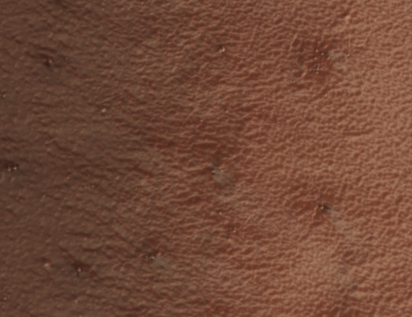